DESCRIPTION
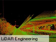
LiDAR (Light Detection And Ranging) has become an established method for collecting very dense and accurate elevation values. This active remote sensing technique is similar to radar but uses light pulses instead of radio waves.
1. Mobile LiDAR Survey and Mapping
2. Terrestrial LiDAR Survey and Mapping
3. Aerial LiDAR Scanning and Mapping